Anexo:Registro Nacional de Lugares Históricos en Providence
Edificio más antiguo del campus de Brown; construido 1770
Esta es una lista de los listados del Registro Nacional de Lugares Históricos en Providence, Rhode Island.
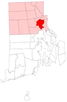
Esta pretende ser una lista completa de las propiedades y distritos en el Registro Nacional de Lugares Históricos en la ciudad Providence, la capital del estado de Rhode Island (Estados Unidos). Se proporcionan coordenadas de latitud y longitud para muchas propiedades y distritos del Registro Nacional; estas ubicaciones se pueden ver juntas en un mapa en línea.
Hay 433 propiedades y distritos incluidos en el Registro Nacional en el Condado de Providence, incluidos 15 Monumentos Históricos Nacionales. La ciudad de Providence es la ubicación de 169 de estas propiedades y distritos, incluidos 12 Monumentos Históricos Nacionales; se enumeran aquí. Las propiedades y distritos ubicados en otros municipios del condado se enumeran por separado. Dos listados, el Canal Blackstone y el Distrito Histórico de Norwood Avenue, se extienden a otras partes del condado de Providence.
Listados actuales
| [1] | Nombre | imagen | Fecha listada | Dirección | Localidad | Resumen |
|---|---|---|---|---|---|---|
| 1 | Casa Nelson W. Aldrich | 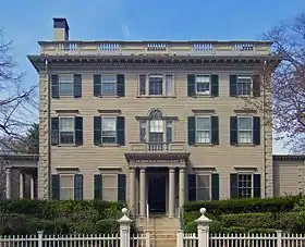 Casa Nelson W. Aldrich |
1976-12-08 | 110 Benevolent St. 41°49′30″N 71°23′46″O |
Providence | Hogar de Aldrich, un veterano senador estadounidense. Hoy sede de la Sociedad Histórica de Rhode Island |
| 2 | Iglesia de Todos los Santos |  Iglesia de Todos los Santos |
1980-01-07 | 674 Westminster St. 41°49′05″N 71°25′09″O |
Providence | Una obra significativa del arquitecto Edward Tuckerman Potter. |
| 3 | Casa Candace Allen |  Casa Candace Allen |
1973-04-11 | 12 Benevolent St. 41°49′29″N 71°24′15″O |
Providence | Un ejemplo del gusto arquitectónico doméstico de las familias ricas de Providence en la década de 1820 |
| 4 | Casa de Zachariah Allen |  Casa de Zachariah Allen |
1994-09-15 | 1093 Smith St. 41°50′39″N 71°26′56″O |
Providence | Un ejemplo bien conservado de una casa de estilo georgiana-federal |
| 5 | America Street School | 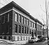 America Street School |
1987-06-18 | 22 America St. 41°49′23″N 71°25′42″O |
Providence | Demolida en 1996.[2] |
| 6 | American Brewing Company Plant | 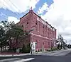 American Brewing Company Plant |
2016-06-21 | 431 Harris Ave. 41°49′29″N 71°26′05″O |
Providence | Un ejemplo bien conservado de una cervecería de última generación de finales del siglo XIX. |
| 7 | Distrito Histórico de Andrew Dickhaut Cottages |  Distrito Histórico de Andrew Dickhaut Cottages |
1984-02-23 | 114–141 Bath St., 6-18 Duke St., y 377 Orms St. 41°50′00″N 71°25′33″O |
Providence | Una colección discreta e intacta de viviendas obreras de finales del siglo XIX. |
| 8 | The Arcade | .jpg.webp) The Arcade |
1971-05-06 | 130 Westminster St. y 65 Weybosset St. 41°49′25″N 71°24′39″O |
Providence | Primer centro comercial cerrado en los Estados Unidos, construido en 1828 |
| 9 | Casa Arnold-Palmer | 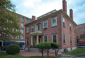 Casa Arnold-Palmer |
1972-01-20 | 33 Chestnut St. 41°49′09″N 71°24′50″O |
Providence | Un buen ejemplo bien conservado de la arquitectura federal tardía. |
| 10 | Aylesworth Apartments | 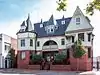 Aylesworth Apartments |
1982-11-12 | 188–194 Broad St. 41°49′00″N 71°25′06″O |
Providence | Los apartamentos construidos especialmente más antiguos de Providence |
| 11 | William L. Bailey House | 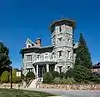 William L. Bailey House |
1973-03-07 | Eaton St., Providence College campus 41°50′31″N 71°26′07″O |
Providence | Ahora conocido como Dominic Hall, la residencia oficial del presidente de Providence College |
| 12 | Beaman y Smith Company Mill | 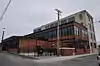 Beaman y Smith Company Mill |
2006-04-20 | 20 Gordon Ave. 41°48′17″N 71°24′57″O |
Providence | |
| 13 | Bell Street Chapel | 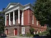 Bell Street Chapel |
1973-03-14 | 5 Bell St. 41°49′07″N 71°26′12″O |
Providence | |
| 14 | Iglesia Congregacional Benéfica | 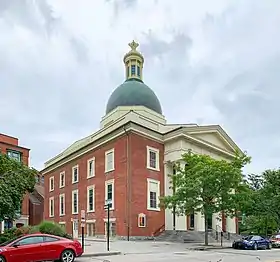 Iglesia Congregacional Benéfica |
1972-01-13 | 300 Weybosset St. 41°49′11″N 71°24′51″O |
Providence | La iglesia más antigua de Providence al oeste del río Providence y un ejemplo destacado del estilo neogriego |
| 15 | Blackstone Boulevard Realty Plat Historic District | .jpg.webp) Blackstone Boulevard Realty Plat Historic District |
1995-06-09 | A grandes líneas Delimitado por Blackstone Boulevard, Rochambeau Ave., Holly St., y Elmgrove Ave. 41°50′54″N 71°23′24″O |
Providence | |
| 16 | Distrito Histórico de Blackstone Boulevard-Cole Avenue-Grotto Avenue |  Distrito Histórico de Blackstone Boulevard-Cole Avenue-Grotto Avenue |
2009-11-12 | A grandes líneas Delimitado por Blackstone Boulevard y Cole, Grotto, President, y Rochambeau Aves. 41°50′27″N 71°23′08″O |
Providence | |
| 17 | Canal Blackstone |  Canal Blackstone |
1971-05-06 | From Steeple y Promenade Sts. to the Ashton Dam; also from the Ashton Dam north to the Massachusetts state line 41°55′16″N 71°25′21″O |
Providence | La lista inicial se extendió desde Providence, a través de Pawtucket y tan al norte como Lincoln; una expansión de 1991 de noviembre de 1 lo extendió hasta la línea estatal; el canal en sí se extendía hasta el condado de Worcester, donde es objeto de listados separados. |
| 18 | Distrito Histórico de Blackstone Park |  Distrito Histórico de Blackstone Park |
1998-06-05 | A grandes líneas Delimitado por the Seekonk River, Laurell Ave., Blackstone Boulevard, y S. Angell St. 41°50′02″N 71°22′56″O |
Providence | |
| 19 | Casa Corliss-Brackett | _side.jpg.webp) Casa Corliss-Brackett |
1970-04-03 | 45 Prospect St. 41°49′39″N 71°24′18″O |
Providence | Construida en 1875 por George Henry Corliss, esta casa es un ejemplo grande y monumental del estilo de villa italiana. |
| 20 | George M. Bradley House |  George M. Bradley House |
1972-01-13 | Eaton St., Providence College campus 41°50′31″N 71°26′14″O |
Providence | |
| 21 | William J. Braitsch y Company Plant |  William J. Braitsch y Company Plant |
2016-07-11 | 472 Potters Ave. 41°48′05″N 71°25′28″O |
Providence | |
| 22 | Brick Schoolhouse | _crop.jpg.webp) Brick Schoolhouse |
1972-12-05 | 24 Meeting St. 41°49′43″N 71°24′34″O |
Providence | Hogar de una de las primeras escuelas gratuitas en los Estados Unidos y la primera escuela de ladrillos en la ciudad de Providence |
| 23 | Distrito Histórico de Bridgham-Arch-Wilson Streets |  Distrito Histórico de Bridgham-Arch-Wilson Streets |
1988-09-01 | A grandes líneas Delimitado por Lester y Bridgham Sts., Elmwood Ave., y Warren y Dexter Sts. 41°48′43″N 71°25′36″O |
Providence | |
| 24 | Distrito Histórico de Broadway-Armory |  Distrito Histórico de Broadway-Armory |
1974-05-01 | Providence; specifically 144-146, 148, 150, y 156-158 Broadway y 226 y 230 Dean St. 41°48′58″N 71°25′46″O |
Providence | Los límites específicos representan un aumento de límite de 2008 de enero de 2 |
| 25 | Brown y Sharpe Manufacturing Company Complex | Brown y Sharpe Manufacturing Company Complex |
2003-04-18 | Promenade, Bath, Calverly, West Park, Holden, y Brownell Sts, y Interstate 95 41°49′48″N 71°25′15″O |
Providence | |
| 26 | John Brown House |  John Brown House |
1968-11-24 | 52 Power St. 41°49′22″N 71°24′16″O |
Providence | Casa georgiana tardía del primer benefactor de la Universidad de Brown; una de las primeras casas grandes construidas en la expansión posrevolucionaria de Providence |
| 27 | Casa Morris Brown | 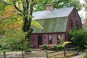 Casa Morris Brown |
1991-08-22 | 317 Rochambeau Ave. 41°50′48″N 71°23′39″O |
Providence | |
| 28 | Moses Brown School | Moses Brown School |
1980-07-24 | 250 Lloyd Ave. 41°50′00″N 71°23′56″O |
Providence | |
| 29 | Burrows Block |  Burrows Block |
1990-09-05 | 735–745 Westminster St. 41°49′05″N 71°25′15″O |
Providence | |
| 30 | Butler Hospital |  Butler Hospital |
1976-10-08 | 345 Blackstone Boulevard 41°50′35″N 71°22′54″O |
Providence | |
| 31 | Iglesia Bautista del Calvario |  Iglesia Bautista del Calvario |
1980-01-07 | 747 Broad St. 41°48′13″N 71°24′29″O |
Providence | |
| 32 | A. F. Cappelli Block | 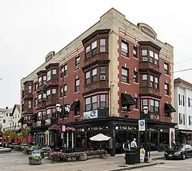 A. F. Cappelli Block |
1980-03-03 | 263–265 Atwells Ave. 41°49′24″N 71°25′38″O |
Providence | Ejemplar de bloques comerciales de uso mixto construidos a principios de siglo. |
| 33 | Casa del doctor George W. Carr | 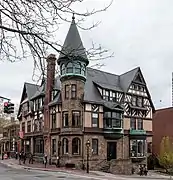 Casa del doctor George W. Carr |
1973-03-07 | 29 Waterman St. 41°49′36″N 71°24′31″O |
Providence | |
| 34 | Iglesia de Todos los Santos | 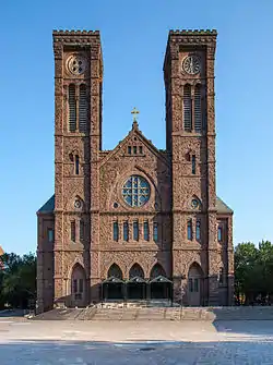 Iglesia de Todos los Santos |
1975-02-10 | Cathedral Sq. 41°49′09″N 71°25′01″O |
Providence | |
| 35 | Central Diner | Central Diner |
2010-01-13 | 777 Elmwood Ave. 41°47′28″N 71°25′21″O |
Providence | |
| 36 | Chemical Building, Fields Point Sewage Treatment Plant | 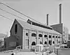 Chemical Building, Fields Point Sewage Treatment Plant |
1989-01-13 | Ernest St. at Fields Point 41°47′40″N 71°23′26″O |
Providence | |
| 37 | Christ Episcopal Church | 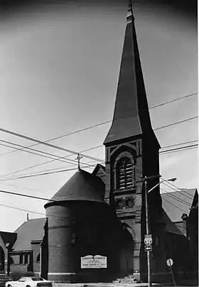 Christ Episcopal Church |
1976-06-30 | 909 Eddy St. 41°48′09″N 71°24′27″O |
Providence | Demolido en 2006 |
| 38 | Distrito Histórico de College Hill | .jpg.webp) Distrito Histórico de College Hill |
1970-11-10 | A grandes líneas Delimitado por the Providence y Seekonk Rivers, Olney, Hope, y Governor Sts., Carrington y Whittier 41°49′35″N 71°24′12″O |
Providence | Contiene muchos edificios y casas bien conservados de los siglos XVIII y XIX, así como Brown y la Escuela de Diseño de Rhode Island |
| 39 | Columbus |  Columbus |
2001-10-19 | Columbus Square, at Elmwood Ave. y Reservoir Ave. 41°47′48″N 71°25′33″O |
Providence | Removida en junio de 2020 |
| 40 | Iglesia Bautista de Congdon Street |  Iglesia Bautista de Congdon Street |
1971-06-21 | 17 Congdon St. 41°49′42″N 71°24′25″O |
Providence | |
| 41 | Casa John Corliss | .jpg.webp) Casa John Corliss |
1974-05-01 | 201 S. Main St. 41°49′23″N 71°24′24″O |
Providence | Un sobreviviente raro de un gran incendio de 1801 y una de las pocas casas que quedan en el área construida antes de la Revolución de las Trece Colonias |
| 42 | Casa Corliss-Carrington | 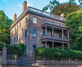 Casa Corliss-Carrington |
1970-12-30 | 66 Williams St. 41°49′21″N 71°24′09″O |
Providence | Casa adosada de estilo adamesco-federal bien conservada de 1812, con columnas de hierro forjado en la fachada frontal |
| 43 | Covell Street School |  Covell Street School |
1976-09-30 | 231 Amherst St. 41°49′24″N 71°26′51″O |
Providence | |
| 44 | Distrito Histórico de Customhouse |  Distrito Histórico de Customhouse |
1975-02-20 | Delimitado por Westminster, Exchange, Dyer, Pine, y Peck Sts. 41°49′26″N 71°24′36″O |
Providence | |
| 45 | Casa de Susan S. y Edward J. Cutler |  Casa de Susan S. y Edward J. Cutler |
2015-04-06 | 12 Woodbine St. 41°50′45″N 71°24′18″O |
Providence | |
| 46 | Davol Rubber Company |  Davol Rubber Company |
1980-06-27 | Point y Eddy Sts. 41°49′02″N 71°24′25″O |
Providence | |
| 47 | Casa de Richard Henry Deming |  Casa de Richard Henry Deming |
1980-01-07 | 66 Burnett St. 41°48′09″N 71°25′38″O |
Providence | |
| 48 | Casa de Edward Dexter |  Casa de Edward Dexter |
1971-06-21 | 72 Waterman St. 41°49′37″N 71°24′15″O |
Providence | |
| 49 | Jeremiah Dexter House |  Jeremiah Dexter House |
1976-10-08 | 957 N. Main St. 41°50′48″N 71°24′19″O |
Providence | |
| 50 | Charles Dowler House |  Charles Dowler House |
1984-02-23 | 581 Smith St. 41°50′09″N 71°25′51″O |
Providence | |
| 51 | Downtown Providence Historic District |  Downtown Providence Historic District |
1984-02-10 | A grandes líneas Delimitado por Washington, Westminster, Empire, y Weybosset Sts.; also along Friendship, Pine, y Richmond Sts.; also 250 y 254 Washington Sts. 41°49′24″N 71°24′48″O |
Providence | El segundo y tercer conjunto de ubicaciones representan aumentos en los límites de 2007 de octubre de 11 y 2012 de julio de 25 |
| 52 | Distrito Histórico de Doyle Avenue | 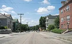 Distrito Histórico de Doyle Avenue |
1990-02-22 | Doyle Ave. from N. Main St. to Hope St. 41°50′19″N 71°24′26″O |
Providence | |
| 53 | Dyerville Mill |  Dyerville Mill |
1979-06-18 | 610 Manton Ave. 41°49′35″N 71°27′42″O |
Providence | |
| 54 | Earnscliffe Woolen-Paragon Worsted Company Mill Complex |  Earnscliffe Woolen-Paragon Worsted Company Mill Complex |
2007-04-04 | 25 y 39 Manton Ave. 41°49′05″N 71°26′39″O |
Providence | |
| 55 | Elizabeth Building |  Elizabeth Building |
1971-11-05 | 100 N. Main St. 41°49′41″N 71°24′38″O |
Providence | Uno de los pocos edificios comerciales sobrevivientes de Providence con una arquitectura de hierro forjado |
| 56 | Distrito Histórico de Elmgrove Gardens |  Distrito Histórico de Elmgrove Gardens |
2005-02-02 | Rochambeau, Morris, y Cole Aves. y Fosdyke y Woodbury Sts. 41°50′52″N 71°23′31″O |
Providence | |
| 57 | Distrito Histórico de Elmwood |  Distrito Histórico de Elmwood |
1980-01-07 | North Section Delimitado por Broad Street y Elmwood Avenue, along sections of Whitmarsh, Moore, Daboll, y Mawney Sts. y Princeton Ave. South Section along Ontario St. y Congress, Lexington, Atlantic, y Adelaide Aves.[3] 41°48′03″N 71°25′23″O |
Providence | |
| 58 | Ernest Street Sewage Pumping Station |  Ernest Street Sewage Pumping Station |
1989-01-13 | Ernest y Ellis Sts. 41°47′42″N 71°23′52″O |
Providence | |
| 59 | Federal Building |  Federal Building |
1972-04-13 | Kennedy Plaza 41°49′33″N 71°24′40″O |
Providence | |
| 60 | Primera Iglesia Bautista |  Primera Iglesia Bautista |
1966-10-15 | N. Main St. between Thomas y Waterman Sts. 41°49′38″N 71°24′33″O |
Providence | La congregación de la iglesia bautista más antigua de los EE. UU., Fundada por Roger Williams (Roger Williams (teólogo)) en 1638; el actual Joseph Brown edificio data de 1775. |
| 61 | Primera Iglesia Universalista |  Primera Iglesia Universalista |
1977-08-16 | 250 Washington St. 41°49′15″N 71°25′04″O |
Providence | |
| 62 | Fleur-de-Lys Studios | .jpg.webp) Fleur-de-Lys Studios |
1992-10-05 | 7 Thomas St. 41°49′40″N 71°24′33″O |
Providence | |
| 63 | Distrito Histórico de Freeman Plat |  Distrito Histórico de Freeman Plat |
1995-06-02 | A grandes líneas Delimitado por Morris, Sessions, Cole, y Everett Aves. 41°50′18″N 71°23′38″O |
Providence | |
| 64 | General Ice Cream Corporation Building |  General Ice Cream Corporation Building |
2008-08-19 | 485 Plainfield St. 41°48′49″N 71°27′16″O |
Providence | |
| 65 | Gloria Dei Evangelical Lutheran Church |  Gloria Dei Evangelical Lutheran Church |
1984-02-23 | 15 Hayes St. 41°49′46″N 71°25′03″O |
Providence | |
| 66 | Iglesia de la Gracia | 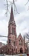 Iglesia de la Gracia |
1972-06-19 | 175 Mathewson St. 41°49′18″N 71°24′50″O |
Providence | |
| 67 | Casa Joseph Haile | .jpg.webp) Casa Joseph Haile |
1972-05-19 | 106 George St. 41°49′32″N 71°24′10″O |
Providence | Una casa adosada independiente de 1806 restaurada ampliamente en la década de 1930 para albergar una colección de muebles y pinturas. |
| 68 | Hay and Owen Buildings | 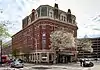 Hay and Owen Buildings |
1982-11-12 | 101 y 117–135 Dyer St. 41°49′24″N 71°24′33″O |
Providence | |
| 69 | Heaton and Cowing Mill | 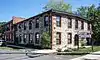 Heaton and Cowing Mill |
2012-6-6 | 1115 Douglas Ave. 41°51′26″N 71°26′34″O |
Providence | |
| 70 | Hope Block and Cheapside |  Hope Block and Cheapside |
1975-05-21 | 22–26 y 40 N. Main St. 41°49′35″N 71°24′33″O |
Providence | |
| 71 | Distrito Histórico de Hope-Power–Cooke Streets |  Distrito Histórico de Hope-Power–Cooke Streets |
1973-01-12 | A grandes líneas Delimitado por Angell, Governor, Williams, y Brook Sts. 41°49′35″N 71°23′51″O |
Providence | |
| 72 | Esek Hopkins House |  Esek Hopkins House |
1973-05-22 | 97 Admiral St. 41°50′29″N 71°25′15″O |
Providence | |
| 73 | Gov. Stephen Hopkins House | 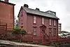 Gov. Stephen Hopkins House |
1970-04-03 | 15 Hopkins St. 41°49′29″N 71°24′25″O |
Providence | Hogar del gobernador colonial y estatal y firmante de la Declaración de Independencia |
| 74 | Thomas F. Hoppin House | 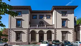 Thomas F. Hoppin House |
1973-02-06 | 383 Benefit St. 41°49′17″N 71°24′11″O |
Providence | Hogar del Instituto Annenberg para la Reforma Escolar en la Universidad de Brown |
| 75 | Thomas P. Ives House | 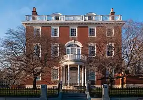 Thomas P. Ives House |
1970-12-30 | 66 Power St. 41°49′24″N 71°24′10″O |
Providence | |
| 76 | Jones Warehouses | 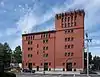 Jones Warehouses |
1980-01-07 | 49–63 Central St. 41°48′50″N 71°25′23″O |
Providence | |
| 77 | Ladd Observatory | 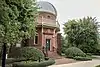 Ladd Observatory |
2000-06-06 | 210 Doyle Ave., at its junction with Hope St. 41°50′21″N 71°23′59″O |
Providence | Un trabajo significativo de la eminente firma local Stone, Carpenter & Willson |
| 78 | Governor Henry Lippitt House | 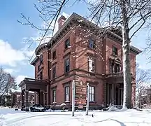 Governor Henry Lippitt House |
1972-11-27 | 199 Hope St. 41°49′41″N 71°23′52″O |
Providence | Casa de villa italiana de Henry Childs con muchos interiores originales |
| 79 | Loew's State Theater | _2012.jpg.webp) Loew's State Theater |
1977-08-19 | 220 Weybosset St. 41°49′15″N 71°24′45″O |
Providence | Ahora conocido como el Centro de Artes Escénicas de Providence |
| 80 | Louttit Laundry |  Louttit Laundry |
2004-03-18 | 93 Cranston St. 41°49′04″N 71°25′27″O |
Providence | Demolida en 2008[4] |
| 81 | Casa Matthew Lynch |  Casa Matthew Lynch |
1978-03-08 | 120 Robinson St. 41°48′29″N 71°25′01″O |
Providence | |
| 82 | Market House |  Market House |
1972-04-13 | Market Sq. 41°49′32″N 71°24′31″O |
Providence | |
| 83 | Casa Israel B. Mason | 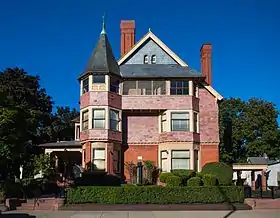 Casa Israel B. Mason |
1977-08-16 | 571 Broad St. 41°48′31″N 71°25′16″O |
Providence | |
| 84 | Mechanical Fabric Company |  Mechanical Fabric Company |
2014-01-08 | 55 Cromwell St., 40, 40R, 50, y 50R Sprague St. 41°48′33″N 71°25′35″O |
Providence | |
| 85 | Merchants Bank Building | 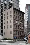 Merchants Bank Building |
1977-11-21 | 32 Westminster St. 41°49′29″N 71°24′36″O |
Providence | |
| 86 | Moshassuck Square |  Moshassuck Square |
1970-09-08 | A grandes líneas Delimitado por Charles, Randall, N. Main, y Smith Sts. 41°50′03″N 71°24′43″O |
Providence | |
| 87 | National y Providence Worsted Mills |  National y Providence Worsted Mills |
2003-07-11 | 166 Valley St. 41°49′16″N 71°26′27″O |
Providence | |
| 88 | New England Butt Company |  New England Butt Company |
1980-01-07 | 304 Pearl St. 41°48′54″N 71°25′22″O |
Providence | |
| 89 | Nicholson File Company Mill Complex | 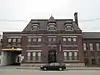 Nicholson File Company Mill Complex |
2005-08-22 | 1–45 Acorn St. 41°49′39″N 71°25′47″O |
Providence | |
| 90 | Nightingale-Brown House | 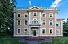 Nightingale-Brown House |
1989-06-29 | 357 Benefit St. 41°49′16″N 71°24′09″O |
Providence | Una de las casas georgianas más logradas del país; renovaciones posteriores y adiciones por Richard Upjohn y terrenos por Frederick Law Olmsted |
| 91 | North Burial Ground |  North Burial Ground |
1977-09-13 | Between Branch Ave. y N. Main St. 41°50′55″N 71°24′24″O |
Providence | |
| 92 | Distrito Histórico de Norwood Avenue | 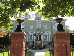 Distrito Histórico de Norwood Avenue |
2002-04-26 | Roughly along Norwood Ave. between Roger Williams Park y Broad St. 41°46′51″N 71°24′12″O |
Providence | Se extiende hasta Cranston |
| 93 | Distrito Histórico de Oakland Avenue |  Distrito Histórico de Oakland Avenue |
1984-11-01 | A grandes líneas Delimitado por Pembroke Ave. y Eaton, Malbone, y Dickens Sts. 41°50′20″N 71°25′48″O |
Providence | |
| 94 | Distrito Histórico de Olney Street-Alumni Avenue | 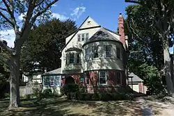 Distrito Histórico de Olney Street-Alumni Avenue |
1989-05-11 | A grandes líneas Delimitado por Olney St., Arlington Ave., Alumni Ave., y Hope St. 41°50′09″N 71°23′53″O |
Providence | |
| 95 | Ontario Apartments | 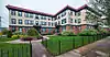 Ontario Apartments |
1998-03-05 | 25–31 y 37–41 Ontario St. 41°48′00″N 71°25′11″O |
Providence | |
| 96 | Oriental Mills | 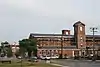 Oriental Mills |
2005-12-23 | 10 Admiral St. 41°50′23″N 71°25′10″O |
Providence | |
| 97 | Our Iglesia de Nuestra Señora de Lourdes | 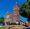 Our Iglesia de Nuestra Señora de Lourdes |
1990-03-15 | 901–903 Atwells Ave. 41°49′32″N 71°26′52″O |
Providence | |
| 98 | Distrito Histórico de Parkis-Comstock |  Distrito Histórico de Parkis-Comstock |
1980-01-07 | Broad St. y Parkis y Comstock Aves.; also 568 y 570-572 Broad St. y 39-41, 54-56, y 60-62 Harvard Ave. 41°48′33″N 71°25′15″O |
Providence | Las direcciones específicas representan un aumento del límite de 1988 de mayo de 5 |
| 99 | Nathaniel Pearce House |  Nathaniel Pearce House |
1972-05-19 | 305 Brook St. 41°49′31″N 71°23′56″O |
Providence | |
| 100 | Distrito Histórico de Pekin Street |  Distrito Histórico de Pekin Street |
1984-11-01 | A grandes líneas Delimitado por Pekin y Candace Sts., Douglas y Chalkstone Aves. 41°50′12″N 71°25′29″O |
Providence | |
| 101 | Perkins Buildings |  Perkins Buildings |
2004-01-30 | 85 Sprague St., 101 y 102 Westfield St. 41°48′37″N 71°25′40″O |
Providence | |
| 102 | Distrito Histórico de Pine Street |  Distrito Histórico de Pine Street |
1978-09-13 | Irregular pattern along Pine St. from Myrtle to Seekill Sts. 41°48′50″N 71°25′06″O |
Providence | |
| 103 | Plain Farm House |  Plain Farm House |
1980-06-27 | 108 Webster Ave. 41°48′48″N 71°27′01″O |
Providence | |
| 104 | Iglesia Congregacional de Plymouth |  Iglesia Congregacional de Plymouth |
2021-03-12 | 1014 Broad St. 41°47′50″N 71°24′48″O |
Providence | |
| 104 | Poirier's Diner | 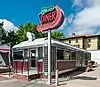 Poirier's Diner |
2003-07-17 | 1380 Westminster St. 41°49′07″N 71°26′01″O |
Providence | Ubicado originalmente en 1467 Westminster St.; se mudó a 1380 Westminster Street en 2011. Opera como "West Side Diner". |
| 105 | Power Street-Cooke Street Historic District | 1974-07-30 | A grandes líneas Delimitado por Angell, Governor, Power, y Hope Sts. 41°49′33″N 71°23′47″O |
Providence | ||
| 106 | Ayuntamiento de Providence |  Ayuntamiento de Providence |
1975-01-23 | Dorrance y Washington Sts. 41°49′26″N 71°24′48″O |
Providence | |
| 107 | Providence Dyeing, Bleaching, Calendring Company |  Providence Dyeing, Bleaching, Calendring Company |
2004-10-18 | 46, 50, 52, y 60 Valley St. y 80 Delaine St. 41°49′07″N 71°26′31″O |
Providence | |
| 108 | Providence Fruit y Produce Warehouse Company Building |  Providence Fruit y Produce Warehouse Company Building |
2005-06-10 | 6–64 Harris Ave. 41°49′40″N 71°25′49″O |
Providence | Demolido en enero de 2008. |
| 109 | Providence Gas Company Purifier House |  Providence Gas Company Purifier House |
2007-06-21 | 200 Allens Ave. 41°48′29″N 71°24′11″O |
Providence | |
| 110 | Distrito Histórico de Providence Jewelry Manufacturing |  Distrito Histórico de Providence Jewelry Manufacturing |
1985-12-05 | Delimitado por Ship St., Ashcroft y Elbow y Hospital Sts., Point y South Sts., Imperial y Claverick Sts., y U.S. Route 195; also Delimitado por U.S. Route 195 y Point, Parsonage, South, Hospital, Elbow, Ashcroft, Richmond, Eddy, y Ship Sts. 41°49′02″N 71°24′39″O |
Providence | El segundo conjunto de límites representa un aumento de límite de 2012 de marzo de 20 |
| 111 | Providence Lying-In Hospital | 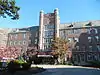 Providence Lying-In Hospital |
1986-08-13 | 50 Maude St. 41°50′08″N 71°25′47″O |
Providence | |
| 112 | Providence Steel y Iron Company Complex | 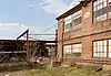 Providence Steel y Iron Company Complex |
2005-08-24 | 27 Sims Ave. 41°49′34″N 71°26′05″O |
Providence | |
| 113 | Providence Telephone Company | 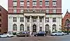 Providence Telephone Company |
1983-08-04 | 112 Union St. 41°49′19″N 71°24′53″O |
Providence | |
| 114 | Providence-Biltmore Hotel |  Providence-Biltmore Hotel |
1977-05-27 | 11 Dorrance St. 41°49′27″N 71°24′49″O |
Providence | |
| 115 | Reservoir Avenue Sewage Pumping Station | 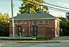 Reservoir Avenue Sewage Pumping Station |
1989-01-13 | Reservoir y Pontiac Aves. 41°47′15″N 71°25′56″O |
Providence | |
| 116 | Return Sludge Pumping Station, Fields Point Sewage Treatment Plant |  Return Sludge Pumping Station, Fields Point Sewage Treatment Plant |
1989-01-13 | Ernest St. 41°47′40″N 71°23′18″O |
Providence | |
| 117 | Rhode Island Hospital Trust Building | .jpg.webp) Rhode Island Hospital Trust Building |
1976-10-22 | 15 Westminster St. 41°49′31″N 71°24′37″O |
Providence | |
| 118 | Rhode Island Medical Society Building | 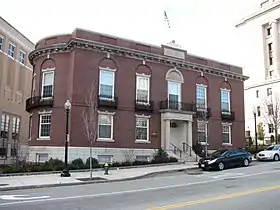 Rhode Island Medical Society Building |
1984-06-04 | 106 Francis St. 41°49′46″N 71°25′00″O |
Providence | |
| 119 | Casa del Estado de Rhode Island |  Casa del Estado de Rhode Island |
1970-04-28 | 90 Smith St. 41°49′48″N 71°24′55″O |
Providence | |
| 120 | Rhode Island Tool Company | 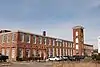 Rhode Island Tool Company |
2004-08-04 | 146–148 W. River St. 41°50′36″N 71°24′56″O |
Providence | |
| 121 | Distrito Histórico de Rhodes Street |  Distrito Histórico de Rhodes Street |
1982-11-12 | Rhodes, Janes, y Alphonso Sts. 41°48′28″N 71°24′32″O |
Providence | |
| 122 | Rochambeau Branch-Providence Public Library | 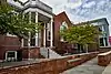 Rochambeau Branch-Providence Public Library |
1998-03-05 | 708 Hope St. 41°50′46″N 71°23′50″O |
Providence | |
| 123 | Rochambeau Worsted Company Mill | 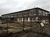 Rochambeau Worsted Company Mill |
2017-07-24 | 60 King St. 41°49′23″N 71°27′13″O |
Providence | |
| 124 | Roger Williams National Memorial |  Roger Williams National Memorial |
1966-10-15 | Delimitado por N. Main, Canal, Smith, y Haymarket Sts. 41°49′48″N 71°24′38″O |
Providence | |
| 125 | Distrito Histórico del Parque Roger Williams |  Distrito Histórico del Parque Roger Williams |
1966-10-15 | Roger Williams Park 41°46′55″N 71°24′43″O |
Providence | |
| 126 | Joseph y William Russell House | 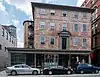 Joseph y William Russell House |
1971-08-12 | 118 N. Main St. 41°49′41″N 71°24′34″O |
Providence | |
| 127 | Iglesia de San José | 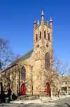 Iglesia de San José |
1974-07-15 | 86 Hope St. 41°49′17″N 71°23′50″O |
Providence | |
| 128 | Iglesia de San Martín | 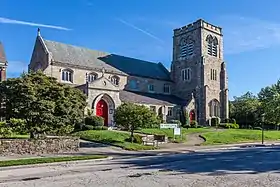 Iglesia de San Martín |
1996-05-16 | 50 Orchard Ave. 41°49′55″N 71°23′10″O |
Providence | |
| 129 | Iglesia de San Miguel |  Iglesia de San Miguel |
1977-03-25 | 251 Oxford St. 41°48′06″N 71°24′52″O |
Providence | |
| 130 | St. Stephen's Church | 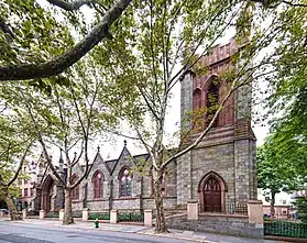 St. Stephen's Church |
1973-02-06 | 114 George St. 41°49′32″N 71°24′04″O |
Providence | |
| 131 | Shakespeare Hall | 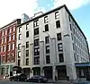 Shakespeare Hall |
1979-06-18 | 128 Dorrance St. 41°49′20″N 71°24′36″O |
Providence | |
| 132 | Shepard Company Building | 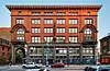 Shepard Company Building |
1976-08-11 | 259 Westminster Mall, 72–92 Washington St. 41°49′22″N 71°24′51″O |
Providence | |
| 133 | Sixth District Courthouse | 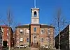 Sixth District Courthouse |
1970-04-28 | 150 Benefit St. 41°49′44″N 71°24′34″O |
Providence | También conocido como Old State House |
| 134 | Sludge Press House, Fields Point Sewage Treatment Plant | 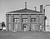 Sludge Press House, Fields Point Sewage Treatment Plant |
1989-01-13 | Ernest St. at Fields Point 41°47′40″N 71°23′24″O |
Providence | |
| 135 | Smith Hill Branch-Providence Public Library | 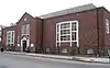 Smith Hill Branch-Providence Public Library |
1998-03-05 | 31 Candace St. 41°50′07″N 71°25′21″O |
Providence | |
| 136 | Distrito Histórico de Smith Hill |  Distrito Histórico de Smith Hill |
1993-11-04 | 57–65 Brownell St., 73–114 Holden St., 23–80 Jewett St., 189–240 Smith St., y 10–18 W. Park St. 41°49′55″N 71°25′08″O |
Providence | |
| 137 | Smith Street Primary School |  Smith Street Primary School |
1984-02-23 | 396 Smith St. 41°50′02″N 71°25′30″O |
Providence | |
| 138 | Sinagoga de los Hijos de Jacob |  Sinagoga de los Hijos de Jacob |
1989-08-24 | 24 Douglas Ave. 41°50′06″N 71°25′02″O |
Providence | |
| 139 | South Providence Branch-Providence Public Library |  South Providence Branch-Providence Public Library |
1998-03-05 | 455 Prairie Ave. 41°48′07″N 71°24′51″O |
Providence | |
| 140 | South Street Station |  South Street Station |
2006-06-30 | 360 Eddy St. 41°49′07″N 71°24′24″O |
Providence | |
| 141 | David Sprague House |  David Sprague House |
1978-05-23 | 7 Harvard Ave. at Taylor St. 41°48′32″N 71°25′06″O |
Providence | Esta casa fue trasladada de su ubicación original en 263 Public St. |
| 142 | State Arsenal |  State Arsenal |
1970-04-28 | 176 Benefit St. 41°49′42″N 71°24′32″O |
Providence | |
| 143 | State Home y School for Dependent y Neglected Children |  State Home y School for Dependent y Neglected Children |
2019-12-30 | Rhode Island College, East Campus, 600 Mount Pleasant Ave. 41°50′38″N 71°27′24″O |
Providence | |
| 144 | Stedman & Fuller Manufacturing Company Complex |  Stedman & Fuller Manufacturing Company Complex |
2021-06-14 | 49 Westfield St. 41°48′37″N 71°25′36″O |
Providence | |
| 144 | Distrito Histórico de Stimson Avenue |  Distrito Histórico de Stimson Avenue |
1973-04-24 | Ambos lados de Stimson Ave. y Diman Pl. entre Angell St. al sur, Hope St. al oeste, y un muro de piedra al norte 41°49′42″N 71°23′44″O |
Providence | |
| 145 | Distrito Histórico de Summit |  Distrito Histórico de Summit |
2003-09-23 | Summit Ave., Rochambeau Ave., Camp St., Memorial Rd., y Creston Way 41°50′52″N 71°23′57″O |
Providence | |
| 146 | Swan Point Cemetery |  Swan Point Cemetery |
1977-10-05 | 585 Blackstone Boulevard; also opposite 585 Blackstone 41°51′09″N 71°23′00″O |
Providence | La segunda dirección representa un aumento de límite de 1978 de noviembre de 28 |
| 147 | Templo Beth-El | 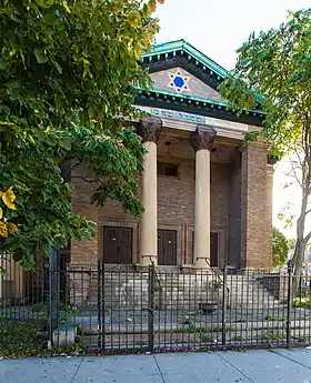 Templo Beth-El |
1988-12-29 | 688 Broad St. 41°48′19″N 71°25′11″O |
Providence | |
| 148 | Distrito Histórico de Trinity Square | 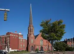 Distrito Histórico de Trinity Square |
1980-01-07 | Broad St. y Elmwood Ave. 41°48′44″N 71°25′24″O |
Providence | |
| 149 | Trinity Square Repertory Theatre |  Trinity Square Repertory Theatre |
1972-06-05 | 201 Washington St. 41°49′19″N 71°25′01″O |
Providence | |
| 150 | U.S. Customshouse | _2016.jpg.webp) U.S. Customshouse |
1972-04-13 | 24 Weybosset St. 41°49′28″N 71°24′36″O |
Providence | |
| 151 | Union Station |  Union Station |
1975-02-20 | Exchange Ter. 41°49′32″N 71°24′50″O |
Providence | |
| 152 | Union Trust Company Building | 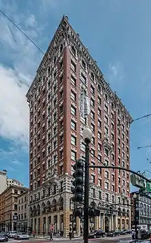 Union Trust Company Building |
1973-03-01 | 62 Dorrance St. 41°49′24″N 71°24′42″O |
Providence | |
| 153 | United States Post Office Annex |  United States Post Office Annex |
2017-12-07 | 2 Exchange Terrace 41°49′35″N 71°24′40″O |
Providence | Ahora conocido como el Edificio Federal John O. Pastore.. |
| 154 | United States Rubber Company Mill Complex |  United States Rubber Company Mill Complex |
2005-08-24 | Delimitado por Hemlock y Valley Sts., Richmond Pl., y the Woonasquatucket River 41°49′40″N 71°26′02″O |
Providence | |
| 155 | University Hall, Brown University |  University Hall, Brown University |
1966-10-15 | Brown University campus 41°49′34″N 71°24′16″O |
Providence | Edificio más antiguo del campus de Brown; construido 1770 |
| 156 | Veterans Memorial Auditorium – Masonic Temple | 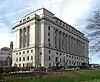 Veterans Memorial Auditorium – Masonic Temple |
1993-11-16 | Junction of Brownell y Park Sts. 41°49′48″N 71°25′00″O |
Providence | |
| 157 | Wanskuck Branch-Providence Public Library | 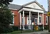 Wanskuck Branch-Providence Public Library |
1998-03-05 | 233 Veazie St. 41°51′04″N 71°26′05″O |
Providence | |
| 158 | Distrito Histórico de Wanskuck |  Distrito Histórico de Wanskuck |
1983-12-01 | A grandes líneas Delimitado por Branch Ave., Louisquisset Pike, y town boundary 41°51′20″N 71°25′56″O |
Providence | |
| 159 | Washington Park Sewage Pumping Station |  Washington Park Sewage Pumping Station |
1989-01-13 | Shipyard St. 41°47′29″N 71°23′24″O |
Providence | |
| 160 | Distrito Histórico de Wayland |  Distrito Histórico de Wayland |
2005-12-08 | A grandes líneas Delimitado por Arlington y Laurel Aves., Weymouth St., Blackstone Boulevard, Butler Ave., y Angell y S. Angell Sts. 41°50′01″N 71°23′20″O |
Providence | |
| 161 | Weybosset Mills Complex |  Weybosset Mills Complex |
2008-01-10 | Dike, Oak, Magnolia, Agnes, y Troy Sts. 41°48′52″N 71°26′31″O |
Providence | |
| 162 | Distrito Histórico de Wesleyan Avenue |  Distrito Histórico de Wesleyan Avenue |
1982-11-23 | Roughly Wesleyan Ave., between Taylor y Broad Sts. 41°48′28″N 71°25′11″O |
Providence | |
| 163 | Distrito Histórico de Westminster Street | Distrito Histórico de Westminster Street |
2003-05-30 | Roughly along Westminster St., between Stewart St. y Sawins Ln. 41°49′06″N 71°25′13″O |
Providence | |
| 164 | Josephine White Block |  Josephine White Block |
1980-01-07 | 737–739 Cranston St. 41°48′17″N 71°26′19″O |
Providence | |
| 165 | Winsor-Swan-Whitman Farm |  Winsor-Swan-Whitman Farm |
1974-05-01 | 416 Eaton St. 41°50′34″N 71°26′35″O |
Providence | |
| 166 | Constance Witherby Park |  Constance Witherby Park |
1975-11-25 | 210 Pitman St. 41°49′37″N 71°23′03″O |
Providence | |
| 167 | Casa Woods-Gerry |  Casa Woods-Gerry |
1971-02-12 | 62 Prospect St. 41°49′42″N 71°24′21″O |
Providence |
Listados anteriores
| [1] | Nombre | imagen | Fecha listada | Dirección | Localidad | Resumen |
|---|---|---|---|---|---|---|
| 1 | North Freight Station |  North Freight Station |
1973-05-07 | Canal St. 41°49′46″N 71°24′42″O |
Providence | Demolido en 1973. |
Referencias
- Numbers represent an ordering by significant words. Various colorings, defined here, differentiate National Historic Landmarks and historic districts from other NRHP buildings, structures, sites or objects.
- «1995 Ten Most Endangered Properties». Providence Preservation Society. Archivado desde el original el 25 June 2014. Consultado el 30 de mayo de 2014. «the building was seen as outdated y in a state of ill repair, which ultimately led to its demolition. »
- National Register of Historic Places Inventory--Nomination Form
- «1995 Ten Most Endangered Properties». Providence Preservation Society. Archivado desde el original el 25 June 2014. Consultado el 30 de mayo de 2014. «What Cheer Laundry was lost in 2008. »